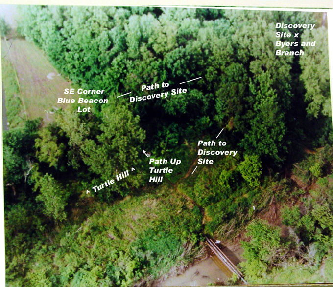
Overhead view of the Discovery Woods
The Paths to the Crime Scene.
I used overhead photos, crime scene sketches, the police videos and my personal visit to the area to create this description (given below) of the paths and access to the crime scene. The Blue Beacon Woods are surrounded by the Blue Beacon Truck Wash on the northwest, the Union 76 Truck Stop directly to the west across the southern end of the Blue Beacon lot, the Interstate and Service Road to the north, a large meadow to the east and the bayou to the south. Across the bayou, visible from some areas, were the Mayfair Apartments. All of the photos below are from police videos taken in 1993.
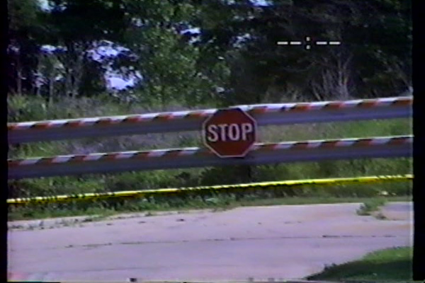
The Dead End of W. McAuley (crime scene tape visible)
From the dead end at West McAuley Drive you leave behind the residential neighborhood. Even from here, the Mayfair Apartments are mostly obscured. There is a path that takes you down to the pipe that crosses the bayou. Just before reaching the pipe from the south side, there is about a five foot drop via a sharp but navigable slope. The pipe itself is about 30 feet across with the water about 3 feet below it. The south and north ends of the pipe are hidden from view from any buildings or businesses. This is confirmed in the videotape taken at the time of the murders. From the north end of the pipe, looking to the northeast, the Blue Beacon Woods hover over you.
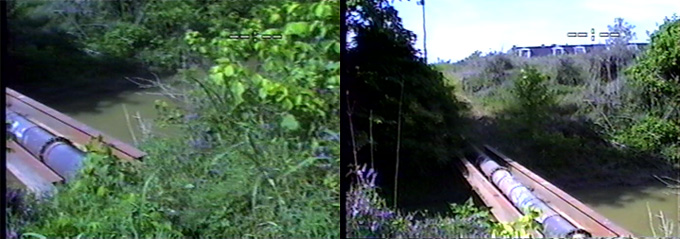
Looking south, two views of the pipe. Taken from the same place the second image has camera tilted up. In the second image the Mayfair Apartments come into view. Although there is undisturbed crime scene tape, the path is already obscured by grass.
There was a path from the pipe that heads north to Turtle Hill where you encounter the southeast end of the Blue Beacon lot. This path is clearly visible in the overhead shot, but is all but invisible in the police video. From the pipe, this path heads north across a brief plain, I estimate 15 yards. As you walk along this, if you turn around, the upper floors of the Mayfair Apartments can be seen. Heading straight, this path goes to Turtle Hill and the southeast corner of the Blue Beacon lot. From the police sketches and overhead shot, there was a path that broke off to the right and entered the Blue Beacon Woods and headed directly to the Byers/Branch discovery site.
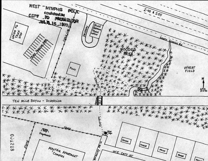
Police sketch of crime scene area including the paths to the west of the discovery site.
Turtle Hill is about six to eight feet tall. From the top of Turtle Hill but before you enter the Blue Beacon lot you can see the totality of the Mayfair Apartments. You pass a line of trees that obscure the southeast corner of the Blue Beacon lot from the Mayfair Apartments. From the southeast corner of the Blue Beacon lot the police video and sketches show a path that leads straight to the Byers and Branch discovery site. Also in the police video it is shown that the trees from the Blue Beacon Woods bulge out and obscure this area from the back of the Blue Beacon. Several single trees partially obscure the view here from the interstate, although the interstate can be seen between the trees.
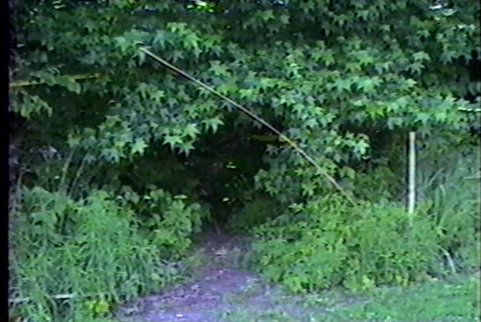
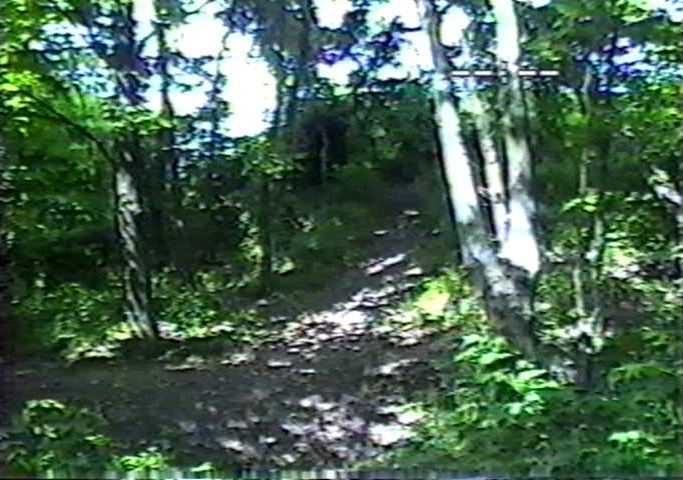
Southeastern corner of Blue Beacon lot looking into trail that lead to discovery site of Byers and Branch. Entryway overgrown.
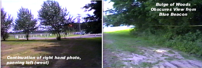
Looking north from the southeastern corner of the Blue Beacon Woods. Trees obscure a view from the Truck Wash which would be to the right and out of the picture.
The video doesn't pan west toward the truck stop, although State Exhibit 15 suggests that there is a direct line of view. It could be argued that the perpetrator could have obscured this view by moving a car or truck up against the entry to the woods. This area is clearly accessible to cars as can be noted by the many ruts in the photo of the ground. In her testimony Melissa Byers described her son Ryan and her husband's search for her missing son, Chris. "There's a little pond or something back there and he said "Ryan drove around the pond and blew the horn on the car to try to" - you know, like to try to - you know, blow the horn on the car in case." Another path leads from an area closer to the Blue Beacon to the woods. This is visible in the sketches and in the video, although the video only shows the path and not its entrance into the woods.
Looking west from the discovery site. The trail on the right goes to the southeastern corner of the Blue Beacon lot (photos above). The trail on the left joins the trail to the pipe. Note, in the interior of the woods, the trails are well-defined.
Two paths head from the discovery site of Moore west toward the meadow. The northeastern path and a slow slope are described in one sketch, and in the same sketch, the southeastern trail heads into a steep slope. In another sketch, only the northeastern path is identified and here it is described as a "dim trail." On the eastern side of the woods there was a single large tree jutting out into the meadow, effectively obscuring any south of it from being seen from the interestate. This tree is visible in exhibit 15. This meadow can be transversed by automobile, in fact, I was approached from this direction during my visit.
There is what is described as a slow slope down on the western (Blue Beacon) side of the ditch to the area down to where Byers and Branch were found, as can be seen in the photo of the trails, above. This slope on the west bank becomes a steep bluff overseeing the area where Moore's body was found.
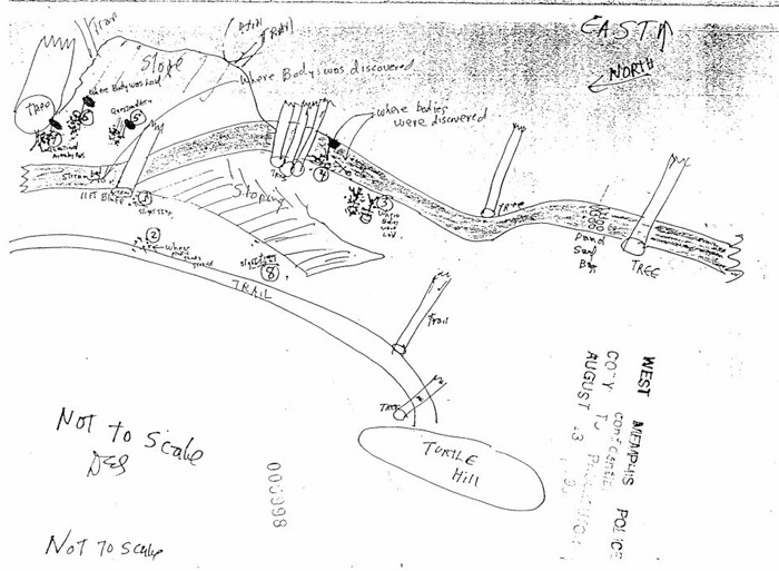
Police drawing of crime scene area. This sketch is more representative of the types of drawings made. Note that some tubes are trails, while other are trees. This drawing includes information not in other drawings, including the trails leading to Moore's body, the slopes, and the bluff overlooking Moore's body.
Access to the woods by car on the western side would require passing by the Blue Beacon Truck Wash. There are no notes or comments from the staff of the Blue Beacon for the late night period. Access to the woods by car on the eastern side could be seen from the interstate. Of course, at that time, nothing unusual was known to be taking place to those passing through West Memphis.
Lost. Part three of triptych
|